Written By: Kristen Cockburn, AAg
In completing a Phase I ESA (Environmental Site Assessment), we use lots of different information sources to form a picture of land uses on a property and surrounding area through history. Some land uses have the potential to pose an environmental risk to the property, so we try to get as much information as we can about an area. One of the primary sources we use are Fire Insurance Plans.
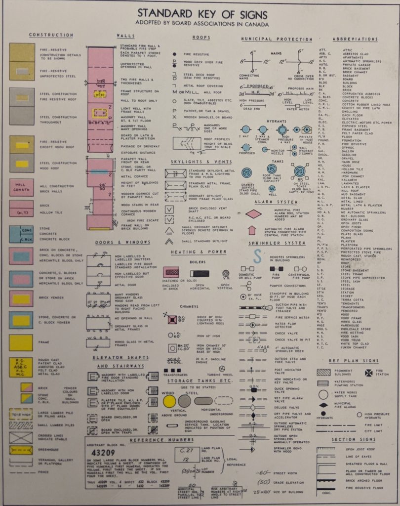
Historically, Fire Insurance Plans (FIPs or maps) were produced for use by insurance companies and documented buildings and some infrastructure within larger towns and cities. These maps were used by insurance brokers to estimate the fire risk of a property to determine levels and cost of insurance, and as documentation of buildings the property if it burned down. Fire Insurance Maps follow a standardized key of colours and symbols to show the construction details of buildings and other features on the property. Most maps in British Columbia were produced by the Sanborn Map Company and the Canadian Underwriter’s Insurance Association, with some of the earliest maps dating from the 1880’s in Vancouver and Victoria[1].
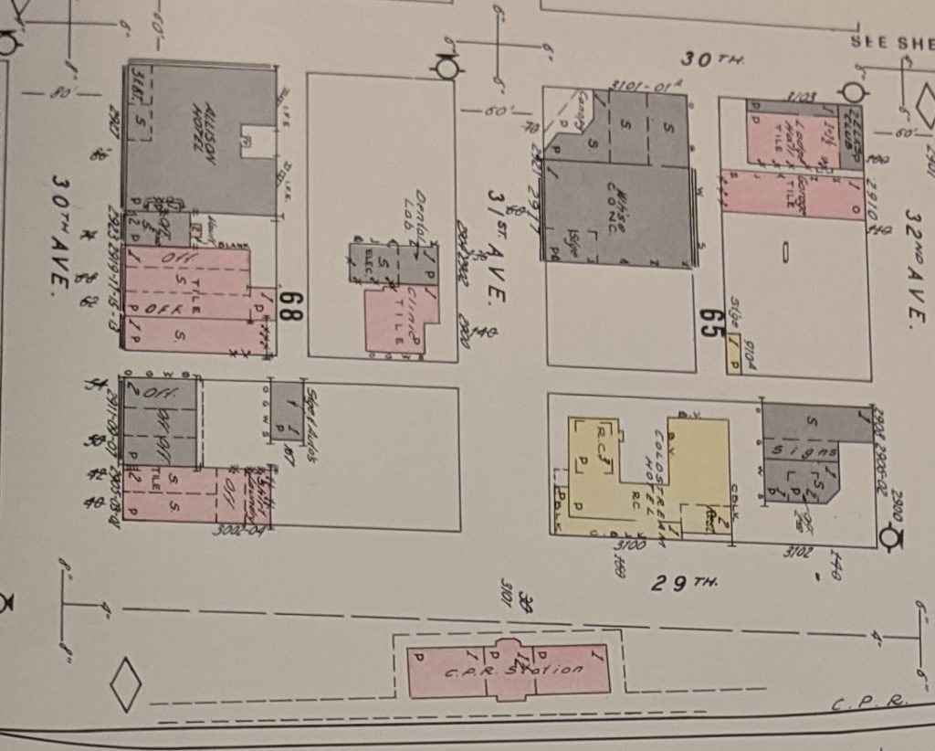
Some FIPs have been digitized online though the National Archives of Canada or other institutions such as universities and museums and are publicly available to view. In addition, local archives may have copies of maps that were donated by insurance agencies when they were replaced by maps on Microfiche in the 1970s and other documentation in the 1980s. Originally, maps were printed and distributed to subscribed insurance agents, who had them bound into books or folios. Prior to 1951, some maps were updated later via a “cut and paste” method for lots that had updates, rather than reprinting the entire set of plans for a few changes1. You can sometimes see maps that may have three different dates based on what has been added. After 1951, individual pages were reissued when changes were noted.
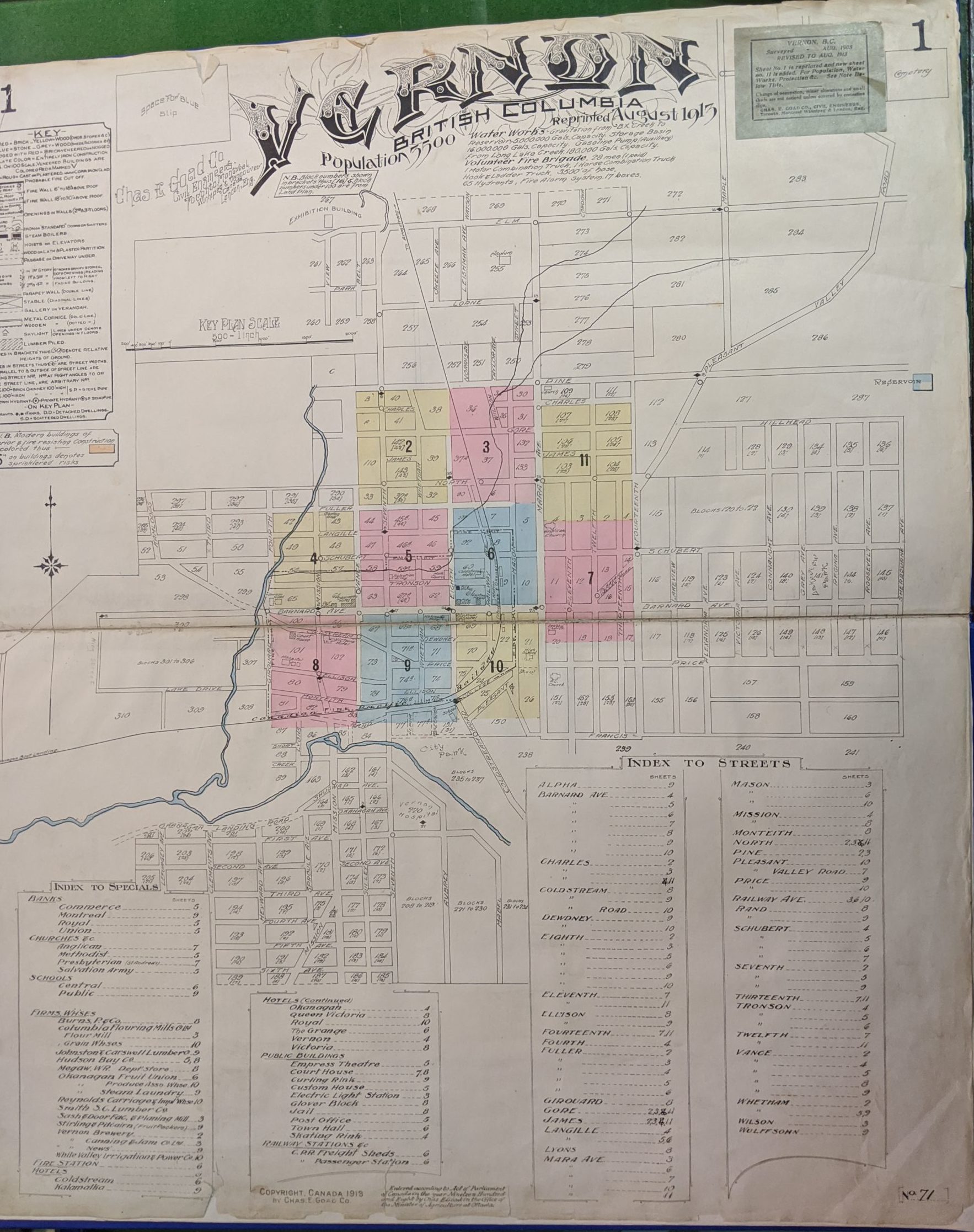
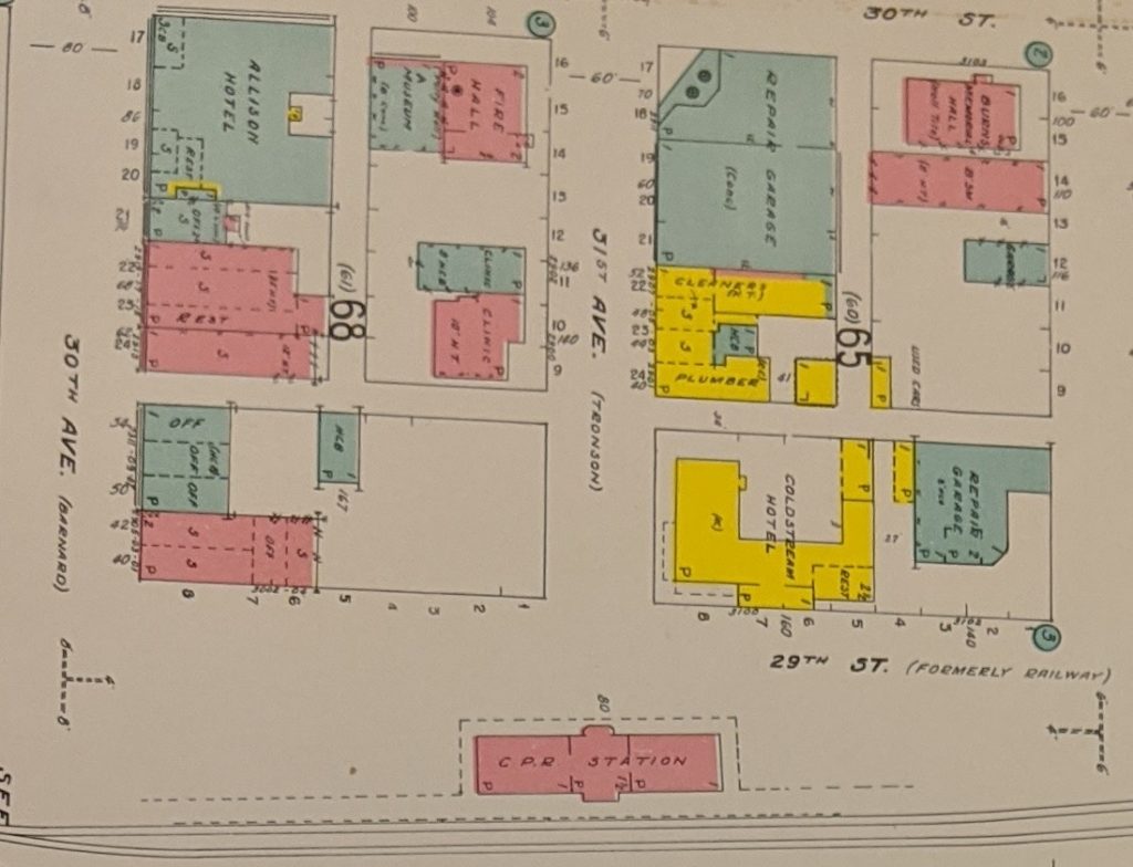
Each set of FIPs has a key on the front page with explanations of what different symbols and colours mean. Next is an overall map of the town or city with numbered blocks showing what page covers that area. These next pages show a neighborhood scale of 50, 100 or 200 ft per inch. Each building is drawn with details added via colors and symbols including the size and shape of the building and the materials used to construct the building such as wood, brick or concrete. There are notes on the number of floors, doors, windows, chimneys, fire protection facilities such as alarms, sprinklers and extinguishers if present. Other notes sometimes indicate the use of the building if it is commercial such as restaurants, grocery stores or bakeries. If a property has a listed use, there is a good change this use may have had a higher risk of fire such as a blacksmith or even theatres. Some industrial operations such as sawmills are detailed with each building named, including tanks used for fuel storage and where maintenance on equipment occurred.
A review of FIPs for a property and the surrounding area may show features that may no longer be present and were not documented in other records. This can include former industrial properties and uses, historical fuel storage tanks and even railway spurs. Labelled buildings and features give us a confirmed identification of buildings whose uses may not have been obvious in aerial photos or through other records. One thing that is especially helpful is the documentation of underground fuel storage tanks, as they are not visible in aerial photos, and in the case of heating oil tanks, would not have any aboveground infrastructure such as fuel pumps.
Unfortunately, FIPs usually only covered a portion of a town or city, with areas of residences or parkland omitted from the plan areas. Coverage of plans may change in each edition issued depending on if there have been changes in land use, or development in other areas of the City.
FIPs can provide a lot of additional information and add one more piece to the puzzle of historical uses of a property. Give us a call if you have questions about a property and either require a Phase I ESA financing or insurance purposes, or just for your own due diligence. We would be happy to help!
[1] Woodward, Francis M. “Fire Insurance Plans and British Columbia Urban History: A Union List,” BC Studies, no. 42 (1979), pp. 13-26.