Written By: Kristen Cockburn, AAg
When an Area of Potential Environmental Concern (APEC) is identified as part of a Phase I Environmental Site Assessment (Phase 1 ESA), we provide recommendations for a Phase II ESA. Depending on the APEC and the estimated potential impacts we may recommend a subsurface investigation to assess the potential impacts to soil and if warranted, groundwater.
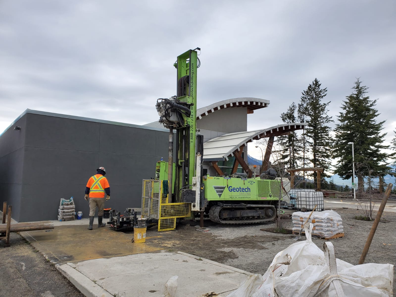
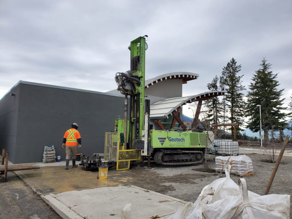
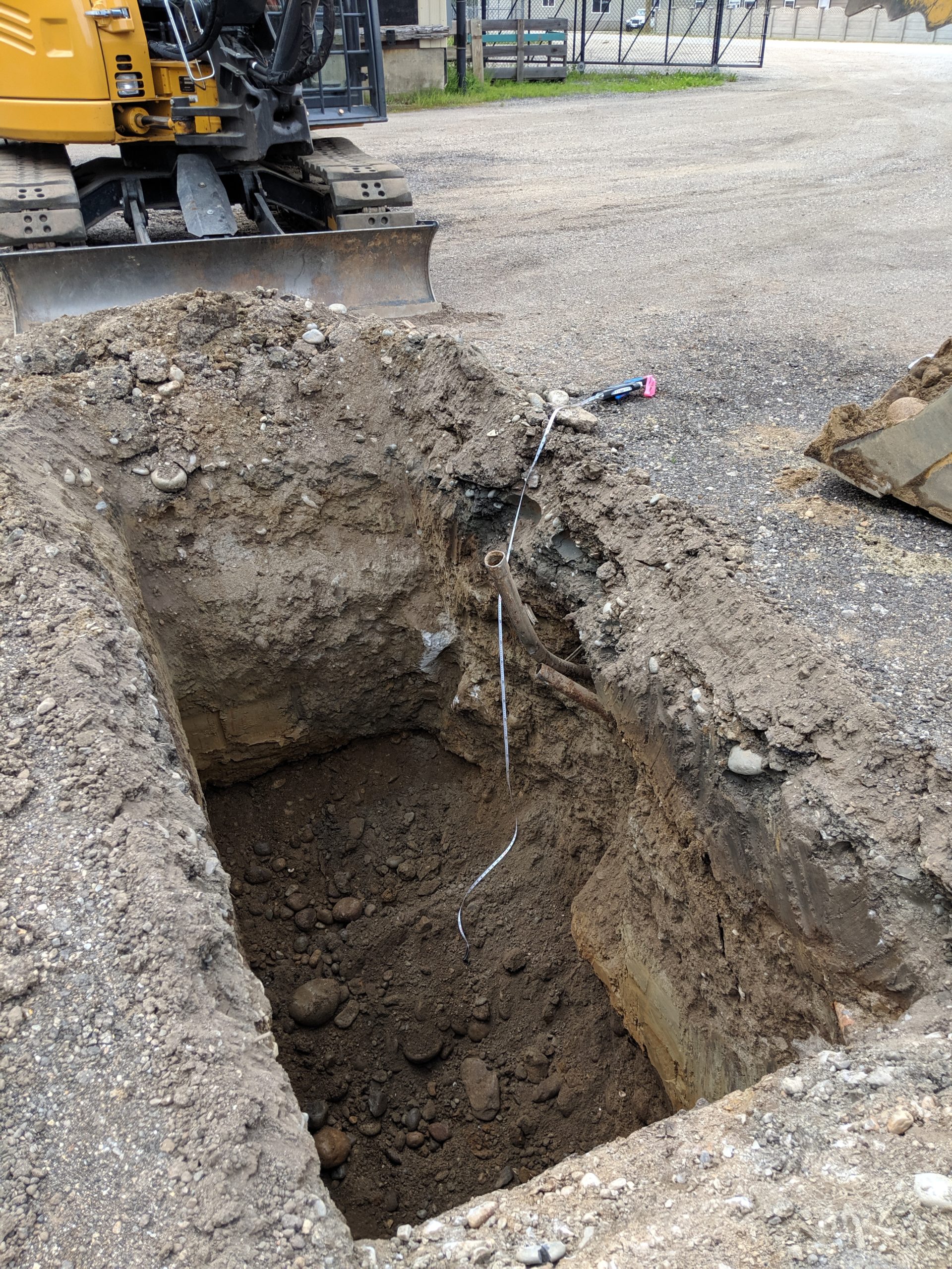
In assessing soil impacts, we have a few different options depending on our target depth. In the case of surficial soil impacts, we may sample with a shovel or hand auger to determine the depth of the impacts and collect samples to confirm soil quality. For impacts to a maximum depth of about 7m (approximately 22ft), we can dig a test pit or an excavation using an excavator, in the right conditions. For deeper impacts, or to investigate groundwater, boreholes are usually advanced using a drill rig, and monitoring wells can be installed.
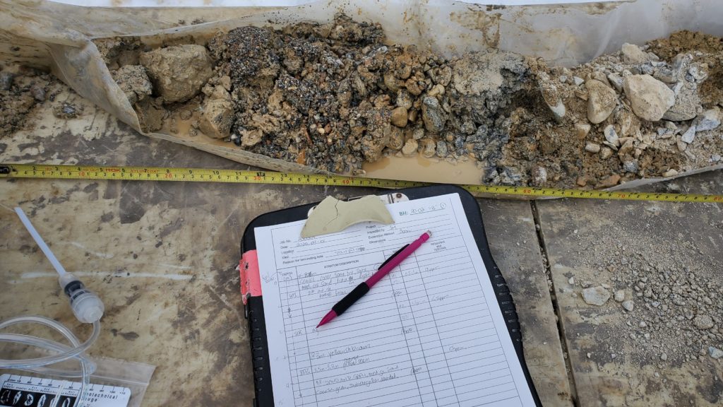
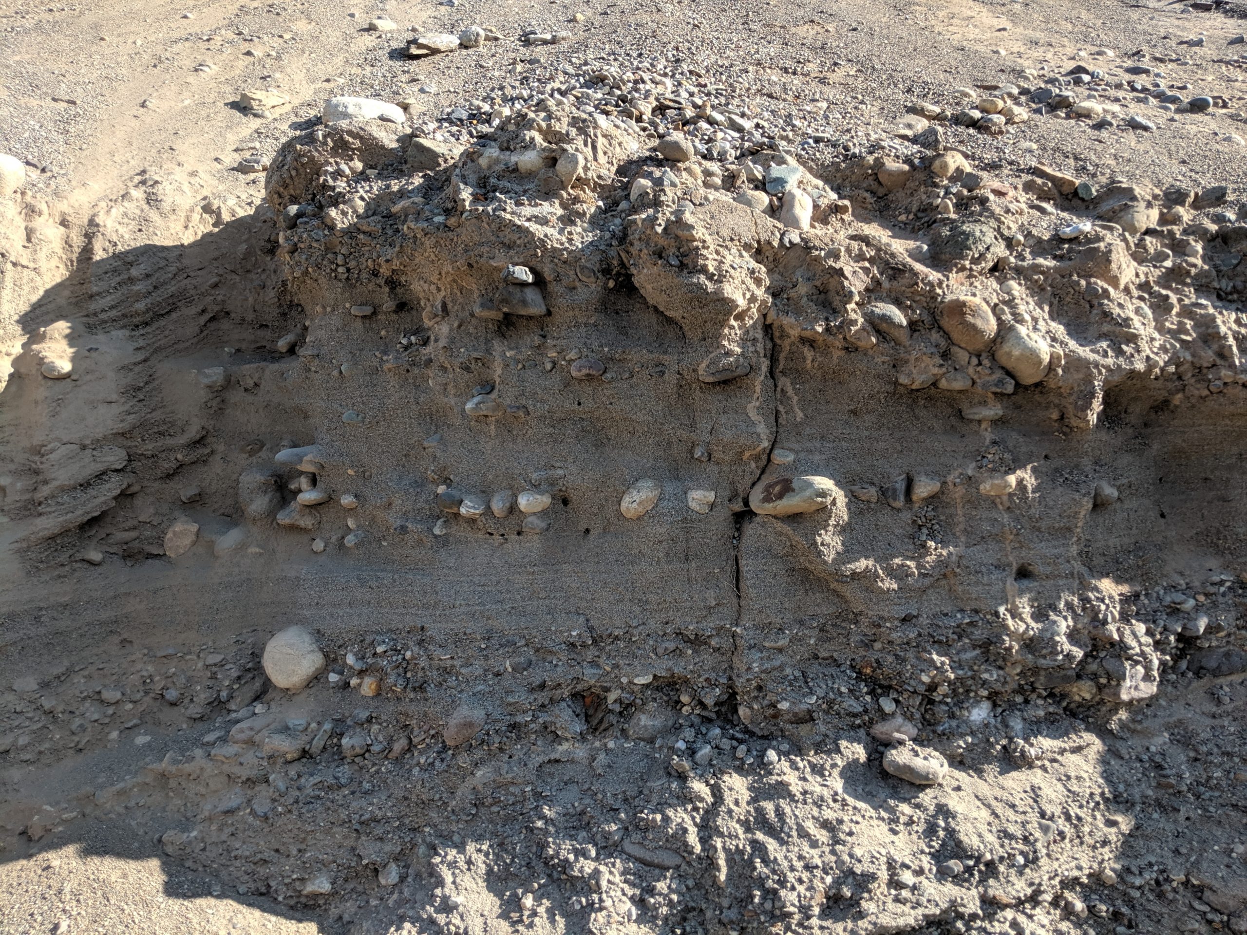
In a test pit or excavation, we are able to visually identify soil stratigraphy (layers of soil) by looking at the sidewalls of the pit, and be able to measure with a tape measure how thick these layers are, and how hard or compact they may be. Soil samples are collected from piles of material placed by the excavator operator, away from the edge of the test pit. Soil collected from the excavation is classified using the Unified Soil Classification System (ASTM D2487-06) and recorded in a log to show depth, density, and thickness of soil units.
The drilling of a borehole allows us to collect soil samples at a greater depth, as well as install monitoring wells if we encounter groundwater to collect water samples for analysis. Different types of drill rigs are used in different soil and based on the estimated well depth will be. We use information from nearby publicly available well logs, knowledge from previous work completed in the area, and local geologic knowledge to make an informed estimate of the depth to groundwater in the area, and the presence of any confining soil layers.
What Can this tell us?
Test pit and borehole logs include important information about the Site including the depth to ground water, areas of seepage, and soil types. Soil units that are coarse like sand or gravel may permit fluids to travel through them and fine soil units like clay may block fluids from moving through them. This can help us determine how contamination may be moving, or migrating, through the subsurface.
Soil types and location are important to identify and understand, as the potential for contaminant migration can vary through different units and soil particle sizes. Contaminants migrate through pores between soil particles with speed of migration depending on how large and well connected the pores are. This is known as transmissivity. In general, contaminant migration through coarse sediments is faster that migration through fine sediments. The density of the sediments will affect the speed of migration as well, with faster migration through loose sediments, and slower migration through dense sediments. Both particle size and density are used to calculate hydraulic conductivity of the soil unit.
Once any soil contamination contacts any groundwater below the Site, this will additionally affect how it moves through soil, with the type of contamination dictating whether it floats on the groundwater surface, dissolves into the groundwater, or sinks through the groundwater to a lower confining layer. If groundwater contamination is suspected, monitoring wells will be installed on the Site to confirm direction of groundwater flow and confirmation of contaminant impacts. We can then use the groundwater flow direction, and information about the transmissivity or hydraulic conductivity of the water bearing unit to understand where the contamination is moving and how fast.
When collecting subsurface samples not only are we sending some of the soil to an analytical laboratory for analysis for suspected contamination, we are collecting additional information to inform our understanding of the Site and how the geology dictates how suspected contamination may move through the soil and groundwater. This information can help us to make decisions on next steps including identifying where to investigate next to identify the extent of contamination and plan cost-effective remediation options.
Where did these soils come from?
The soil types and their sequences below ground surface can tell us a lot about the geologic history of the area and the processes that shaped our landscape. Within the Okanagan and interior of British Columbia, a large proportion of near-surface stratigraphy is the result of glacial or post-glacial sediment deposition overlying bedrock associated with intrusive volcanism and uplift of metamorphic rocks associated with the Okanagan Fault. Most of the near surface soils are associated with the most recent glacial period. The Fraser Glaciation began approximately 25,000 years ago with the beginning of the glacial melt approximately 18,000 years ago[1]. Glaciers carved our landscape by eroding peaks to plateaus and infilling valleys with layers of till a mix of sediment and rock that has been crushed and transported by a glacier. Due to the weight of ice over the till as it was formed, these layers are generally dense, and can be as dense as rock. Deposits of thick sands and gravels can indicate glacial outwash, with laminated fine deposits showing evidence of ponded water such as lakes.
In the Okanagan Valley, an ice dam at Vaseaux Lake formed the precursor to Okanagan Lake, known as Glacial Lake Penticton. This lake covered the valley forming finely layered silt and clay deposits. These layers are exposed in areas of southeast Kelowna, Naramata and Summerland with the near vertical silt bluffs, and finely layered clay deposits.
Well graded, clean sands with a lack of finer particles such as silt or clay can indicate a historic beach environment, while layered sands, silts and gravel can indicate fluvial deposition by running water such as a river or a creek.
Each site fills in a little bit more of the history for us and allows us to tell a more thorough story and to better predict condition on nearby sites with similar conditions.
Sage has conducted subsurface investigations throughout BC and if you would like to find out more please feel free to contact us.
[1] Roed, Murray A. and Greenough, John D. Okanagan Geology. 2004. Kelowna Geology Committee.