Written By: Kristen Cockburn, AAg
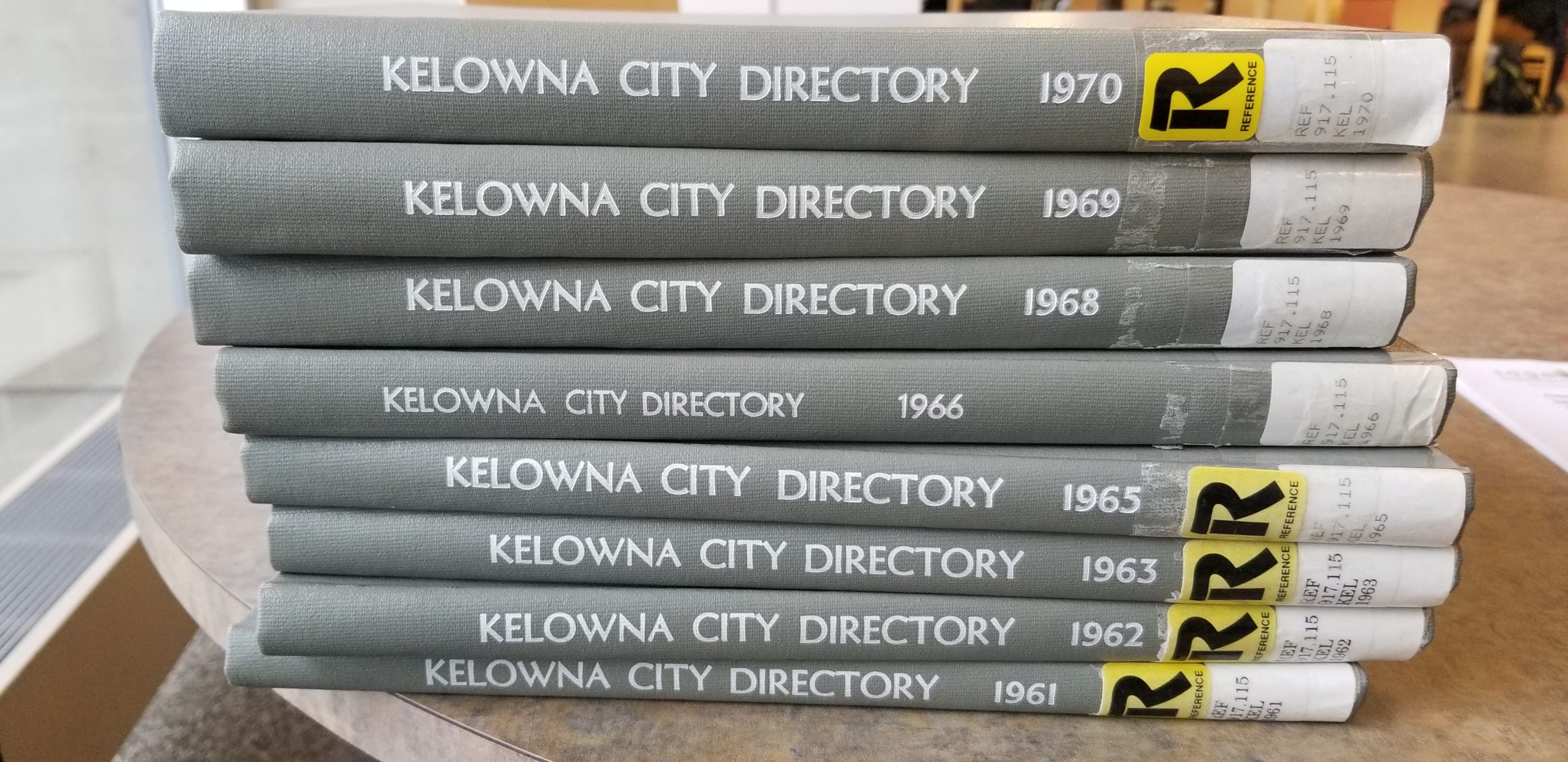
City Directories are one source we use to understand the historical uses of a property and what was present within the surrounding area. City directories listed businesses in the city and served as a means of advertising for businesses and providing their address and contact information. Directories also listed the names of people who lived in the city, their vocation, and their addresses, as collected through door to door surveys. The earliest City Directory in British Columbia was published in 1860 for the City of Victoria, when BC was still a British Colony. The Directory for Victoria in 1863 included advertisements for merchants and lodging in San Francisco, Forks of Quesnelle River (now a ghost town in BC), New Westminster, Port Douglas, Lillooet, and Alkali Lake on the route to the Cariboo Goldfields within the Colony of British Columbia. City Directories were published every few years, or even every year through to the year 2001, when the ability to search for business information on the internet made the publishing of City Directories less valuable.
City Directories are often found in the reference collections of local libraries, with some copies held by museums and archives. A selection of City Directories for British Columbia and some cities between 1860 and 1955 have been digitized by the Vancouver Public Library and are publicly available online[1]. Most larger cities would have had a selection of directories published over time, while smaller or more rural areas may have had their town listed in a larger directory with limited detail.
The first “Guide to the Province of British Columbia” was published in 1877, six years after BC became a province of Canada. The first directory within the interior of BC was for Revelstoke in 1897, based on its importance with the railway, and proximity to Rogers Pass. The first directory specifically for the City of Vancouver was for 1899 -1900, and Kamloops got its first directory in 1913. The City of Vernon’s first directory was published in 1948-1949 and included the reverse lookup section. The City of Kelowna’s first directory was additionally published in 1948, however civic addresses in the Rutland area were not added until the 1970’s, when Rutland was merged with the City of Kelowna in 1973 by the provincial legislature.

City Directories are commonly used by individuals conducting genealogical research, tracing back family names through the alphabetical listings of city residents including their addresses and phone numbers where available. When we conduct an environmental search, we use the reverse listings, where occupants are listed by address. This is a feature specific to City Directories that is not included in a regular phone book. This allows us to search a radius around the subject property to understand what has been there over time. Most directories in the Okanagan started including the reverse listings in the 1950s and 1960s, as cities grew. Some exceptions are rural areas around larger cities, where individual addresses were not listed, and names were listed under a road name.
One thing that makes these searches interesting and sometimes a little more complicated is the changing of street names over time, and even local area names. For example, before the City of Vernon was named in 1887, it was listed as “Priest’s Valley” in the British Columbia directory under the Okanagan area in 1884-1885. Another example is “Pandosy Street” in Kelowna, was listed as “Pendozi” prior to 1959. Usually a directory will list the former name in the edition where the street name has changed, or we will look up cross streets to ensure that we are looking at the same area.
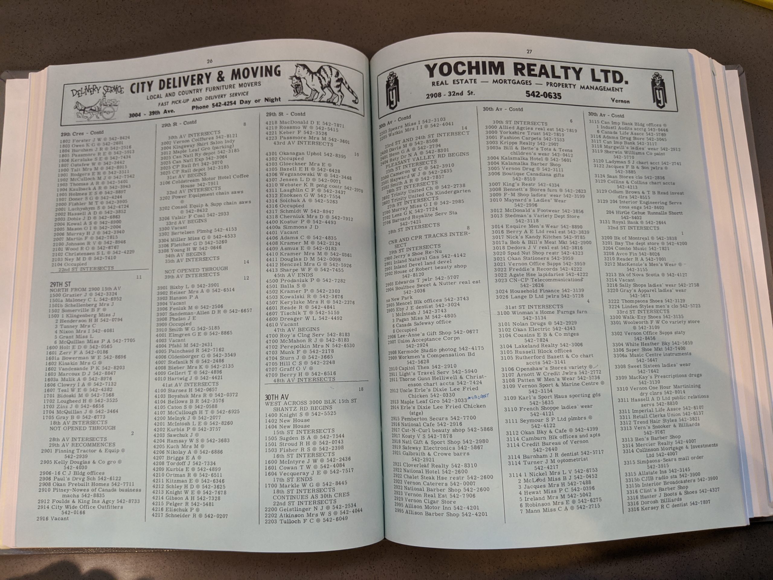
As part of a Phase I Environmental Site Assessment, civic addresses within a 250m radius of the centre of the property are searched within the reverse look up portion of the City Directories. We record the listed occupants of the subject property, and any properties within that 250m radius that appear to have a land use that may present an environmental risk including any Schedule 2[2] uses listed within the British Columbia Contaminated Sites Regulation. Some of these uses include chemical or fuel manufacturing and distribution, mining, milling and metal smelting, transportation, waste disposal and wood, pulp and paper industries. Within a city, some of the smaller commercial uses that have the potential to pose a risk are gas stations, vehicle repair, dry cleaners, welding or machinery shops and towing yards.
City Directories hold a wealth of information that can be used for both genealogical and environmental research. I find it very interesting to see how our cities developed over time, how different areas have changed from agricultural, to residential and commercial. It is fascinating to be able to see a building on an aerial photo or fire insurance plan and be able to assign to that building a name of who lived there or what took place there.
[1] https://bccd.vpl.ca/index.php
[2] http://www.bclaws.ca/civix/document/id/complete/statreg/375_96_04#Schedule2